Sunoue
To Be Continued
To Be Continued
+
We visited them
▲
They visited us
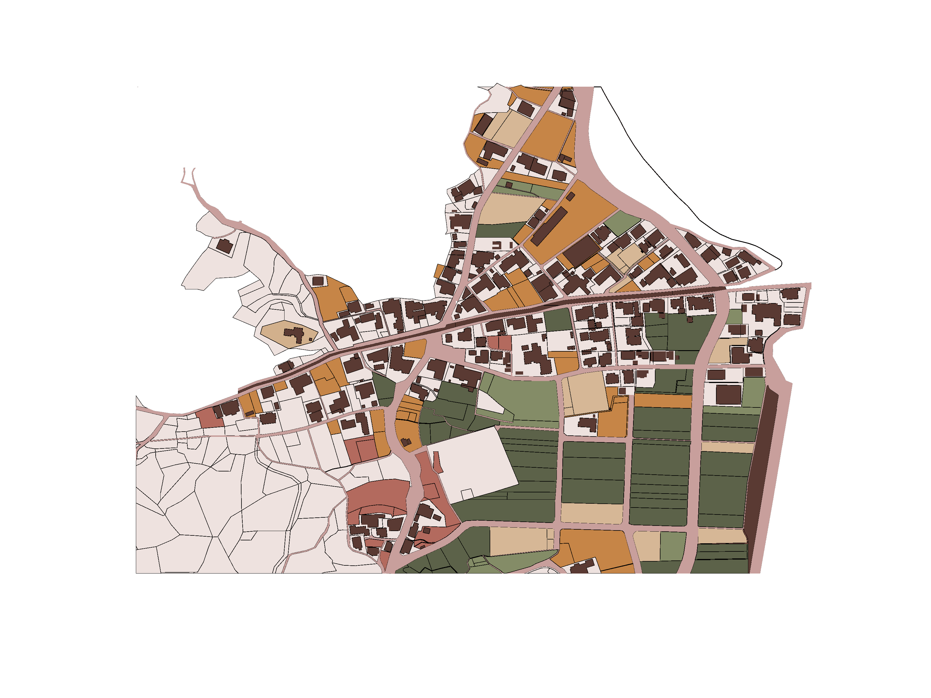
Land use
Whole farm
Part farm
Tended
Unused / 1–2 yr
3–5 yr abandoned
Built
Homes
Roads
Other (school, reservoir…)
N
A
B
C
D
E
F
G
1
2
3
4
5
6
7
Sunoue — 周の江 · 1:5000
Level of Use
Level 1 — Fully Farmed
Actively cultivated land in regular production.
Level 2 — Partially Farmed
Land in partial use, some sections left fallow.
Level 3 — Tended
Maintained but not actively farmed.
Level 4.1 — Recently Abandoned
No active use in the last 1–3 years.
Level 4.2 — Abandoned 3+ Years
Long-term abandonment, land reverting to nature.


Type
Title
Subtitle